
7 Days in Guatemala: Atitlan, Antigua & Tikal
Cruise across the deep blue waters of Lake Atitlán to the vibrant streets of San Juan La Laguna. Just east, enter the historic valley of Antigua Guatemala, where the iconic colonial arch frames the dramatic peak of Volcán de Agua. Finally, fly north into the deep jungles of Petén to stand atop Temple IV at Tikal, gazing out over the emerald forest canopy and the ancient North Acropolis.

In Guatemala’s rugged southern highlands, historic towns like Antigua and Chichicastenango thrive under the watch of dramatic active volcanoes like Fuego and Pacaya. Wander through the historic Panchoy Valley, where cobblestone streets lead past the striking yellow facade of Iglesia de La Merced and the collapsed pillars of San José Cathedral. Throughout this region, vibrant local Kaqchikel and Tz’utujil communities navigate the deep waters of Lake Atitlán in traditional wooden boats and cultivate crops along steep hillsides beneath the majestic peaks of the San Pedro and Tolimán volcanoes.
Venturing further north into the sprawling Petén department, the highlands give way to the untamed Maya Biosphere Reserve and its dense tropical canopy. Here, the landscape transitions into solid white limestone—the very rock the ancient Maya quarried by hand to sculpt their monumental pyramids. To explore this pristine northern wilderness, follow shaded trails past towering Ramón trees to reach the ancient, stone-roofed sweat baths of Tikal and the panoramic lakeside platforms of Structure 216 at Yaxha. Above these historic plazas, spider monkeys leap through the high branches, while Morelet’s crocodiles rest in the shallow reeds bordering Lake Yaxha.
Lake Atitlan
The Soul of Guatemala
Tikal
Heart of the Maya World
Antigua Guatemala
The Colonial Heart of Guatemala
Chichicastenango
Cultural in color
Guatemala: Trip Highlights
Throughout the western highlands, the indigenous communities surrounding Lake Atitlán depend on traditional boats to maintain vital trade networks between the waterfront towns. Step inside the artistic enclave of San Juan La Laguna to witness local women boil carrots, native tree bark, and plants to extract rich, natural dyes for raw cotton textiles. Just north of the lake in Chichicastenango, immerse yourself in a legendary outdoor market, weaving through stalls where local artisans trade carved cedar dance masks, handwoven huipiles (traditional Maya blouses), and aromatic discs of copal incense.
Nestled beneath the striking peak of Volcán de Agua, the historic city of Antigua showcases its sophisticated colonial engineering through hidden underground water cisterns beneath the Plazuela de la Merced. Nearby, learn how cloistered nuns once utilized the private corridor of the iconic Santa Catalina Arch to cross the cobblestone streets unseen by the public. For a dramatic shift in landscape, an optional excursion takes you south to the rugged slopes of Volcán Pacaya, where alpine pine forests abruptly give way to dried black lava fields that still radiate intense heat from the active MacKenney cone.
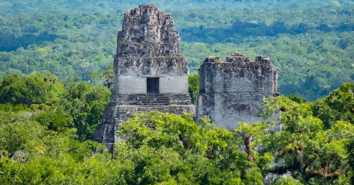
Deep in the vast Petén basin, ancient architecture adapts dramatically to master the surrounding tropical rainforest. Within the monumental ruins of Tikal, the ancient royal family constructed Temple IV to soar into the sky, breaking through the dense jungle canopy to create a permanent physical landmark visible across the endless forest. Nearby at the lakeside archaeological site of Yaxha, Maya architects aligned the Twin Pyramid Complexes from east to west, utilizing the open stone courtyards as celestial tracking arenas to mark sacred 20-year calendar cycles.
Day 1: La Aurora Airport & Atitlan Reserve
La Aurora Airport & Atitlan Reserve
Your journey begins outside the arrival terminal of La Aurora International Airport, where a scenic three-hour drive west sets off toward the majestic highlands surrounding Lake Atitlán. The highway spans 115 kilometers across the central mountain ridges, leading you smoothly to the edge of Panajachel, where you can make an exceptional optional stop at the Atitlán Nature Reser. Within the reserve’s forested boundaries, you’ll traverse well-maintained dirt trails and cross thrilling hanging bridges suspended high in the jungle canopy, catching close-up glimpses of native coatis foraging among the trees. Near the entrance, a short path guides you into a massive mesh dome—a beautifully enclosed butterfly house where vibrant native species flutter peacefully amidst lush tropical flora
Panajachel, Lake Atitlan
From the reserve, follow the main road 2 kilometers southeast directly into the heart of Panajachel. The vibrant life of the town revolves dynamically around Calle Santander, a bustling commercial avenue lined with colorful artisan stalls showcasing intricate handwoven textiles and masterfully carved woodcrafts. Just a single block north of this avenue, you’ll discover the historic Iglesia de San Francisco; this monumental 16th-century stone church has miraculously withstood multiple powerful earthquakes over the centuries, earning its title as the oldest standing architectural structure on Lake Atitlán.
Stroll just 600 meters southeast of the main commercial district to reach the peaceful Jucanya neighborhood. At this serene residential edge, watch the San Francisco River empty into the lake, creating tranquil shallows where local fishermen repair their traditional nets and elegant herons hunt for small fish. From the river bank, the Waterfront Boardwalk invites you on an 800-meter stroll west along the scenic shoreline. As you walk along the railings, you’ll look directly across the water at the dramatic, towering peaks of the San Pedro, Tolimán, and Atitlán volcanoes. Keep an eye out in the late afternoon for the Xocomil—a powerful, legendary local wind that builds up suddenly, churning the calm lake waters into choppy, dramatic waves.
Santa Catarina, Palopó
Leaving Panajachel behind, wind your way 6 kilometers south along the scenic lake road to the picturesque village of Santa Catarina Palopó. A spectacular high viewpoint at the edge of the village perfectly frames the landscape of traditional adobe houses below, which are beautifully painted by residents with vibrant blue geometric squares and traditional Mayan textile patterns. Descend to the street level to explore the vibrant Parque Central, bordered by the historic Iglesia de Santa Catarina Palopó and the local Municipalidad (town hall).
Step inside the family-run workshops of the nearby Centro Cultural, where master local weavers demonstrate the intricate art of backstrap weaving, securing traditional tension looms to wooden posts to handcraft exquisite fabrics. Unlike neighboring communities that traditionally weave with red threads, Santa Catarina’s artisans distinctively use rich shades of deep blue and turquoise cotton to mirror the shimmering lake waters, rendering their textiles instantly recognizable. Just 300 meters down the hillside from the main square, the natural Santa Catarina Hot Springs flow gently through the shoreline rocks into the shallow lake margins. Tucked away from the main street, you’ll see how local families regularly gather here, utilizing the naturally heated thermal waters to bathe and wash vibrant clothing directly on the lakeside rocks.
San Antonio Palopó
Continue your journey 5 kilometers south as the road hugs the dramatic cliff edges, leading you into the traditional village of San Antonio Palopó. Marvel at the steep, terraced agricultural fields of onions and fragrant anise carved meticulously into the dirt hillsides rising sharply right above the street and overlooking the expansive waters below. Perched majestically on a high ridge, the Iglesia de San Antonio Palopó offers an unparalleled panoramic view across the entire lake basin. This village remains one of the few communities where local men proudly wear their traditional attire daily, wrapping handwoven rodilleras (checkered wool cloths) over their trousers.
Follow the winding cobblestone street as it drops 200 meters down the hillside, leading you directly into Cerámica Palopó, a celebrated cooperative of local pottery workshops. Inside the bustling workrooms, you can watch artisans expertly operate foot-pedal wheels to shape raw clay before meticulously hand-painting intricate, traditional geometric patterns onto plates and vessels. Tucked away in the narrow alleys behind the main shops, you’ll find the traditional wood-fired brick kilns. Here, craftsmen carefully load the dried ceramic pieces inside, baking the clay in the intense late-afternoon heat just as the sun begins its spectacular descent behind the massive silhouettes of the volcanoes.
Day 2: Lake Atitlán Village Hopping
San Juan La Laguna
Departing from the Panajachel public docks, step aboard a traditional boat for a scenic 15-kilometer journey across the deep waters toward San Juan La Laguna. As the cool lake breeze sweeps across the surface, marvel at the dramatic, forested slopes of the towering San Pedro Volcano framing your approach to the island pier. Stepping ashore, a vibrant pedestrian walkway sheltered beneath a canopy of colorful hanging umbrellas guides you up the hillside directly into the village’s main commercial district.
This bustling street leads you 200 meters inland to the renowned Casa Flor Ixcaco, a celebrated women’s textile cooperative. Inside their vibrant workrooms, master Tz’utujil weavers spin raw cotton by hand and demonstrate how they boil carrots, local tree bark, and cochineal (small, wild red insects) to extract rich, natural dyes. You’ll also learn about Ixcaco—a rare, sacred strain of naturally brown cotton cultivated in the surrounding hills that requires absolutely no artificial coloring.
Just 100 meters east, explore Rupalaj K’istalin, a tranquil medicinal herb garden meticulously tended by local midwives. As you re-emerge onto the main streets, take time to admire the striking, hand-painted murals. These artwork-covered walls beautifully illustrate local Tz’utujil history, cosmology, and ancestral legends. Beyond the town boundaries, winding dirt paths rise 400 meters into the hillside cacao farms, where fragile cacao plants thrive beneath the protective shade of towering canopy trees.
San Pedro La Laguna
From San Juan, a brief 10-minute boat ride west delivers you to the bustling public dock of San Pedro La Laguna. The pier opens onto a narrow, energetic street lined with welcoming hostels and cafes, winding 800 meters south toward the town cemetery before opening into expansive concrete squares. On these open patios, local farmers spread high-grade agricultural export beans across the ground to dry in the brilliant sun before the roasting process begins.
From this area, trace the road 400 meters north into the bustling Indoor Municipal Market. Inside the innovative, plastic-free market stalls—where a pioneering municipal law strictly bans single-use bags—vendors wrap fresh produce in broad, organic maxán leaves (large native plant leaves used traditionally to protect food). Here, explore stalls overflowing with fresh lake fish, dried chilies, and patín, a traditional Tz’utujil delicacy of salted fish slow-cooked in a rich tomato sauce.
Because the town climbs sharply against the steep base of the volcano, residents expertly navigate motorized tricycles instead of cars to move through the narrow, high-traffic market streets. Just 200 meters east of the market, stop at the Museo Tz’unun ‘Ya, an intimate local history museum whose fascinating interior exhibits detail the dramatic volcanic origins and geological formation of Lake Atitlán.
San Marcos La Laguna
A scenic 15-minute boat ride north brings you directly to the rustic wooden pier of San Marcos La Laguna. From the docks, step into a tranquil haven where pedestrians stroll beneath thick tree canopies along peaceful dirt pathways that are physically blocked from vehicular traffic. Charming wooden signs along these shaded lanes point toward the open-air yoga studios, peaceful meditation retreat centers, and organic vegan cafes that define the town’s renowned holistic culture.
Follow the main path 300 meters west into the serene boundaries of the Cerro Tzankujil Nature Reserve. Quiet, shaded dirt trails wind through the protected forest here, providing an ideal sanctuary to spot endemic local birds far from the busy commercial docks. The primary reserve trail continues 200 meters to a famous wooden cliff-jumping platform built directly over the deep lake water, known locally as El Trampolín. From this point, winding dirt trails climb 800 meters behind the residential areas, ascending directly into the lush agricultural zone. These upper pathways cut through fragrant avocado orchards, offering a peaceful, elevated viewpoint over the lake as the late-afternoon sun drops behind the volcanic peaks.
Day 3: Chichicastenango Market & Antigua Guatemala
Chichicastenango Market
Heading north from Lake Atitlán, your route winds deep into the rugged highlands of the Quiché department. Just before entering the town, the highway skirts the serene Laguna de Lemoa, a tranquil roadside lake where the perfectly still, glass-like surface beautifully mirrors the surrounding alpine pine forests. Continuing 5 kilometers north, the mountain highway brings you into the vibrant heart of Chichicastenango, culminating at the sacred Iglesia de Santo Tomás. On the ancient stone steps leading into the church, local Maya spiritual leaders swing heavy metal censers, sending dense clouds of aromatic copal incense (a native tree resin) drifting into the crisp mountain air. Step through the heavy wooden doors to witness a profound fusion of ancestral customs and faith, where the church floor is deeply carpeted in fresh pine needles, glowing candles, and traditional liquor offerings.
From the church entrance, a historic flight of stone stairs drops directly down into the bustling Central Market Square. Immerse yourself in an energetic maze of outdoor stalls overflowing with masterfully woven textiles, meticulously carved wooden dance masks, and traditional clay pottery. Just behind the main textile displays, take the stairs down into El Fondo, the town’s enclosed basement vegetable market. In this atmospheric subterranean section, local vendors trade fresh agricultural produce and raw meats directly alongside vibrant food stalls serving steaming, authentic highland delicacies.
Returning to the main public square, look across to the western edge where the striking white facade of the Capilla del Calvario sits positioned exactly opposite Santo Tomás, watching quietly over the bustling market activity below.
From the chapel, a short walk west down the hillside leads you directly into the historic General Cemetery. Wander along the concrete pathways lined with majestic family mausoleums, brilliantly hand-painted in vivid shades of pink, turquoise, and yellow to celebrate and honor ancestral spirits.
Continue walking north along the street to reach the legendary La Morería, a famous, multi-generational mask-maker’s workshop. Step inside the historic workrooms to watch skilled artisans meticulously carve wooden ceremonial masks and hand-embroider heavy velvet dance costumes decorated with metallic threads and small, shimmering glass mirrors used in traditional highland festivals.
Antigua Guatemala & Convento Santa Clara
Leaving Chichicastenango behind, your route travels south into the crisp, high-altitude region of Tecpán. Along this high-mountain stretch, traditional roadside smokehouses invite you to take a savory break. Inside these rustic eateries, local cooks serve exceptional artisan smoked chorizos (spiced pork sausages) and warm corn tortillas pulled straight off a traditional clay stove. Continuing southeast, the road descends gracefully into the spectacular Panchoy Valley, welcoming you into the legendary colonial capital of Antigua Guatemala.
Your exploration of this UNESCO World Heritage city begins at the sprawling Convento de Santa Clara on the eastern side of town. Beyond the grand open courtyards and the majestic ruined church structure, follow a hidden stone staircase leading down into the subterranean baking chambers of this historic cloistered convent.
Tanque La Union & Arco de Santa Catalina
Just a single block north of the convent ruins, admire Tanque La Unión, an iconic colonial public washing plaza framed by historic archways where locals still gather. From here, follow the cobblestone street three blocks west into the historic Plaza Mayor, the central heartbeat of the city. In the center of the park, water flows gracefully from the famous stone Mermaid Fountain. The beautifully restored Baroque facade of the Catedral de San José spans the entire eastern edge of the square, where the majestic main hall remains open for daily spiritual services. Look across the plaza to the southern border to admire the grand Palacio de los Capitanes Generales, a colonial government headquarters defined by its striking, two-story double stone archways.
From the plaza’s northern edge, follow the iconic Calle del Arco as it runs three blocks north, leading you directly beneath the world-famous yellow Arco de Santa Catalina. The street culminates two blocks further north at the magnificent Iglesia de La Merced. Take a moment to appreciate its elaborately detailed yellow ultra-Baroque facade, which beautifully catches the golden last light of the day just as the historic municipal streetlights glow to life across the city.
Day 4: Discover Antigua & Optional Volcán Pacaya Hike
Plaza Mayor & Palacio de Los Capitanes Generales
Step out into the crisp morning air of Antigua Guatemala as low clouds drape just beneath the majestic peak of Volcán de Agua. Traditional delivery trucks rattle over the historic cobblestones, bringing fresh produce from the nearby farming community of Alotenango directly into the city center. The temperature remains delightfully cool within the shadows of the single-story colonial homes before the morning sun illuminates the valley.
Your walking exploration begins at the historic Plaza Mayor (also known as Parque Central), the civic and historical heartbeat of the Spanish colonial government. In the center of the shaded park, admire water flowing from the historic Sirens’ Fountain (Fuente de las Sirenas), designed in the 1700s to provide public drinking water to the city. Bordering the southern edge of the plaza stands the imposing Palacio de los Capitanes Generales, recognized by its majestic, two-story row of stone arches spanning the entire block.
Catedral de San José & Hospital de San Pedro
Directly across the cobblestone avenue sits the beautifully restored front section of the Catedral de San José, its white plaster walls standing intact against the sky. Follow a quiet interior path past the main altar to a stone staircase that leads into the Sunken Crypt of San José Catedral. Down in these dark, subterranean burial chambers, candlelight illuminates the soot-stained ruins of the historic tomb where the famous Spanish conquistador Pedro de Alvarado was ultimately laid to rest.
Continuing down the street from the cathedral, discover the fascinating Hospital de San Pedro Claver Ruins. Tucked out of sight behind an active, modern medical clinic, these surviving colonial courtyards remain exceptionally quiet, offering a rare look at how the church cared for the sick and vulnerable during the 16th century.
Mercado Central of Antigua & ChocoMuseo
Walk four blocks west into a dramatic shift of scenery, where the serene colonial streets give way to the vibrant tapestry of Antigua’s sprawling Central Market. Beyond the bustling outer vendor stalls selling vibrant textiles, the path leads into the energetic pathways of the market. Here, local Kaqchikel Maya and Ladino families walk shoulder-to-shoulder through the tight spaces to purchase wholesale sacks of black beans, dried chilies, and raw sugarcane. Deep inside this authentic section, local cooks operate small food stalls known as picanterías (traditional lunch counters). Settle onto a plastic stool to enjoy a rich lunch of pepián—a thick, savory traditional meat stew crafted from roasted pumpkin seeds—served alongside steaming, handmade corn tortillas.
Stroll back toward the center of the city to visit the interactive ChocoMuseo artisan workshop, which demonstrates how Maya farmers historically prepared chocolate. Step into the aromatic room to watch artisans roast raw cacao over an open fire, crack away the husks, and grind the rich nibs by hand into a glossy paste on a traditional volcanic stone metate. Conclude the experience by savoring a rich cup of traditional hot chocolate, spiced with native chili and cinnamon.
Iglesia de San Francisco, El Calvario & San Bartolomé Becerra
Following the street to the eastern edge of the city grid leads you directly to the striking yellow walls of the Iglesia de San Francisco El Grande. Inside the main sanctuary of this highly revered church sits the sacred tomb of Hermano Pedro, where local residents line up daily to knock gently on the wooden coffin and ask for physical healing.
West of the church, the beautiful, tree-lined Alameda de El Calvario runs south until the avenue ends at the tranquil El Calvario Vineyards and Gardens. Located far beyond the reach of ordinary tourists, this serene complex hides sprawling garden beds and majestic weeping willow trees (sweeping, elegant trees with cascading branches that drape gracefully toward the ground).
Following the winding dirt road out of the gardens brings you into San Bartolomé Becerra, a peaceful residential village. Looking past the open garage doors of the homes reveals traditional woodcarvers shaping intricate religious statues and workers rolling fresh incense entirely by hand. The pleasant aroma of burning cedar drifts into the street from these hidden ateliers, where master carvers use precision chisels to coax figures of Catholic saints from raw blocks of wood. These family-run spaces supply the wooden statues and hand-rolled incense used inside the colonial churches back in the center of Antigua. The rhythmic sound of hand tools echoes against the brick walls while a friendly stray dog sleeps in a sunlit doorway.
After exploring, ride a traditional three-wheeled tuk-tuk back into the city grid, dropping off at Café No Sé—an atmospheric, candle-lit tavern famous for pouring small-batch mezcal from unlabelled glass bottles.
Optional tour to Volcán Pacaya
For those seeking adventure, the thrilling trek up the active Volcán Pacaya begins at the traditional San Francisco de Sales trailhead. A winding dirt path cuts through a dense pine forest, rising steadily along the mountainside. The alpine tree line terminates abruptly at the scenic Cerro Chino ridge, exposing the dramatic, dark volcanic rock of the main basin.
Descending from the ridge, the trail leads directly into the expansive lava fields. Here, you will tread across a surreal landscape of jagged escoria—solidified volcanic rock left behind by the powerful 2010 eruptions. Intense heat radiates from the ground as the path approaches the active fumarolas (natural volcanic heat vents). At these remarkable rock openings, your expert guides utilize the underground thermal heat to roast marshmallows on wooden sticks. Just beyond these active vents, stop at the unique The Lava Store, a rustic cinderblock shop where local artisan David Perez designs and sells beautiful, custom jewelry crafted entirely from local volcanic rock.
The dirt path circles back up to the main ridge line. From this spectacular elevation, your viewpoint faces west toward the monumental peaks of the Agua, Fuego, and Acatenango volcanoes, providing an unforgettable view as the afternoon sun drops behind the active, smoking silhouette of Volcán Fuego.
Day 5: Flores Island & Yaxha Sunset
Mundo Maya Airport, Lake Petén Itzá & El Remate
Take a brief domestic flight from La Aurora International Airport in Guatemala City, descending into Mundo Maya International Airport as you enter the lush, lowland department of Petén. Leaving the airport terminal in Santa Elena, enjoy a drive along the shoreline of Lake Petén Itzá, stopping briefly in the tranquil lakeside community of El Remate.
Here, traditional Itzá Maya families work within breezy, open-air workshops, using fine hand files to shape dark blocks of jobillo. This striking tropical hardwood features unique, tiger-like stripes that craftsmen transform into intricate decorative bowls. From these cultural workshops, embark on a drive along an unpaved, rustic dirt road cutting straight through dense jungle terrain to reach the entrance of the ancient city of the Yaxha Archaeological Site.
Lake Yaxha & The Aguada Reservoir
Begin your immersive exploration at the site’s dedicated Visitor Center, sitting surrounded by the flooded banks of Lake Yaxha. Scan the thick, muddy banks to spot elusive Morelet’s crocodiles masked in the shallows, while majestic Snail Kites sweep overhead on the hunt.
Just inland from the visitor center, discover The Aguada, a massive depression carved into the earth by ancient Maya engineers to store vital rainwater for the dry season. This historic artificial pond now serves as a thriving habitat for native frogs and herons hunting among the reeds. Nearby, examine the deep cuts in the white limestone floor marking the ancient quarry, where workers cut and hauled the heavy stone blocks used to build the monumental pyramids.
Plaza of the Birds & Sacnab Lake Trail
Along the lake’s edge, explore Group A (also known as The Inlet Group), consisting of small residential mounds positioned beside the ancient docks. These simple structures served as the humble living quarters for local fishermen and traders operating along the active lake routes.
Head inland from the shoreline into the denser jungle foliage to discover the exclusive Plaza of the Birds (Group B), an elite residential compound named for the intricate avian pottery unearthed inside its tombs. The low branches overhanging this stone courtyard offer an intimate canopy, perfect for spotting rare crested guans searching for wild fruit. Step away for a peaceful stroll along the Sacnab Lake Trail. This secluded pathway offers absolute silence, making it easy to find the distinct, heavy footprints of a Baird’s tapir pressed into the soft mud.
Astronomical Complex & the Plaza of the Carved Stones
Follow the trail back into the sacred core of the archaeological site to enter the majestic Plaza C, the Astronomical Commemorative Complex. Here, the ancient Maya tracked the solar equinoxes; standing along the precise line of platforms reveals the exact seasonal alignment of the rising sun.
Straight past Plaza C lies the impressive Complex of the Twin Pyramids—the Plaza of the Carved Stones—an open ceremonial arena designed for grand celebratory rituals. The limestone sculptures positioned in the grass here exhibit weathered profiles carved with unmistakable Tikal-style iconography. Located just behind the eastern pyramid, discover Group F (the Northern Court), which sits shrouded beneath a thick blanket of vines. Peering past the hanging foliage along the base of the central platform reveals original, brilliant red pigment still clinging to the sheltered limestone walls.
The Lincoln Road & Structure 216
Starting at the edge of Plaza C, set off along The Lincoln Road, a magnificent sacbe—a raised white limestone highway—leading straight into the epicenter of Yaxhá. The towering Ramón trees lining this historic avenue act as a natural thoroughfare for curious spider monkeys swinging through the high canopy branches.
After walking down this white stone road, the grand East Acropolis rises above the forest floor as a dedicated ceremonial platform. Dominating this sacred space is Structure 216—widely known as the Temple of the Red Hands—the most prominent and iconic temple pyramid on the site. Ascend the wooden steps to the summit to witness an unparalleled panoramic view over the continuous jungle canopy and the reflection of the afternoon sun on Lake Yaxhá and Lake Sacnab.
Maler Group Palace, North Acropolis & South Acropolis
Located past the East Acropolis under a thick canopy, discover the fascinating Maler Group, a detached residential palace slowly being embraced by ancient jungle roots. Nearby, explore the monumental North Acropolis, a grand triadic temple complex featuring a massive central platform supporting three separate pyramids.
Ascending the central structure offers an uninterrupted view facing toward the endless, pristine wilderness of the Maya Biosphere Reserve. Directly across the stone plaza sits the South Acropolis, an intriguing labyrinth of elite residential rooms. Walking through the interior corridors and private courtyards reveals intact, original wooden lintels still supporting the heavy stone doorways.
Plaza of the Shadows & Ecolodge El Sombrero
Past the North Acropolis sits the highly fortified West Acropolis & Plaza of the Shadows, which once served as the administrative heartbeat of the ancient city. The thick, overarching tree canopies shading this secluded courtyard provide a favored resting spot for native howler monkeys escaping the midday heat.
As dusk approaches, stroll down the main pathway to return to the tranquil Lake Yaxha Shoreline docks. Watch in the fading light as small bats emerge from the jungle canopy to skim for insects above the water’s ripples. Conclude your day by traveling along the forest route outside the park gates for a memorable dinner at Ecolodge El Sombrero. At this solar-powered eco-outpost, culinary artisans serve exquisite plates of fresh blanco—a prized local whitefish sourced directly from Lake Yaxha—on a wooden deck while the evening chorus of nocturnal frogs begins to echo across the water.
Day 6: Tikal Pyramids & Flight to Guatemala City
Tikal, Visitor Center & Sendero de Las Esculturas
Leaving the shores of Flores Island in the early morning, embark on a scenic drive north toward the legendary Tikal National Park. After passing the park gates, follow the two-lane road through the dense jungle canopy, keeping watch for native wildlife like coatimundis or elusive ocellated turkeys that occasionally cross the route. This jungle approach leads directly to the main visitor lot, a shaded clearing encircled by towering Ceiba trees characterized by thick, buttressed trunks.
Begin your exploration at The Park Visitor Center, where a detailed, raised 3D topographical relief model displays the immense scale and architectural arrangement of the ancient limestone plazas. Nearby, step onto the shaded pathway of the Sendero de las Esculturas as it winds into the subtropical forest. Along this trail, spot exotic ocellated turkeys showing off their vibrant blue skin and peacock-colored feathers while foraging among the pristine foliage.
Aguada Las Perdices & Twin Pyramid Complexes
Look high into the overarching branches to observe the long, bag-like nests woven by native Montezuma Oropendolas hanging overhead. From the main route, turn onto a secluded side pathway to reach Aguada Las Perdices, a vital jungle water reservoir where fresh animal tracks occasionally mark the soft shoreline mud.
Trace your steps back toward the primary trail to examine several ancient chultuns—deep, underground stone chambers engineered by the Maya to protect and store food supplies. Continuing along the forest trail brings you into the impressive Complex Q and R twin pyramid groups, which display carved circular altars and limestone stelae recording the completion of sacred 20-year calendar cycles.
Palace of the Grooved Walls, Temple of the Inscriptions & Mundo Perdido
From these complexes, wander down a narrow pathway to explore Group G, also known as the Palace of the Grooved Walls, an expansive residential compound. Walk through its historic, vaulted stone hallways where the sound of your footsteps echoes off the ancient walls. Afterward, follow the main trail south to behold the remote Temple VI, or Temple of the Inscriptions, where thousands of intricate hieroglyphic glyphs remain carved into the back of its massive stone roof comb.
Walk west along the forest trail to enter the legendary Mundo Perdido (The Lost World), a monumental astronomical observatory complex. Ascend the eastern stone platform, which provides an exact line of sight to the central structures used by ancient Maya astronomers to track seasonal solstice alignments.
Plaza of the Seven Temples, Temple V & The Bat Palace
Located just past the observatory lies the fascinating Plaza of the Seven Temples, a grand stone courtyard uniquely containing three separate ancient ball courts constructed side-by-side. From here, follow the stone pathway to stand at the base of the towering Temple V, a dramatic pyramid renowned for its sheer, flat back wall rising straight out of the rich forest floor.
Turn northwest into the dense tree canopy to discover The Bat Palace, also known as the Palace of Windows, a dark, multi-chambered stone building sitting quietly beside the ancient reservoir. Afterward, weave back through the shaded trails toward the secluded South Acropolis, a sprawling, forested residential complex where playful spider monkeys regularly forage among the high branches as the late afternoon light begins to filter through the canopy.
Temple IV, Central Acropolis & The Royal Sweat Baths
Follow the primary trail west to arrive at the base of the monumental Temple IV (The Temple of the Two-Headed Serpent), where sturdy wooden staircases scale the immense exterior wall. Climb to the top platform to enjoy a panoramic view over the endless jungle canopy, watching the historic stone roof combs of Temples I, II, and III pierce the emerald tree line.
Set off east along the Tozzer Causeway to reach the heart of the site, entering the magnificent Central Acropolis—also known as the Maler Palace—an elite residential compound of multi-level courtyards. Explore the intimate inner rooms to view the original raised stone benches that once served as sleeping platforms for ancient Maya rulers. Afterward, step toward the northern terrace to view The Royal Sweat Baths, small stone-roofed steam chambers used exclusively by the elite for ritual purification before major ceremonies.
The Great Plaza, Temple I, Temple II & the North Acropolis
Step north out of the residential courtyard to emerge onto the majestic grass lawn of The Great Plaza. Stand in the very center of this sacred space and clap your hands to experience how acoustic sound crisply bounces off the towering limestone structures surrounding you. Framing the east and west ends of the plaza stand the iconic Temple I (Temple of the Great Jaguar) and Temple II (Temple of the Masks), constructed as eternal burial monuments for King Jasaw Chan K’awiil I and his queen.
Ascend the designated wooden staircase of Temple II to reach the upper platform, where you can examine The Historical Graffiti of Temple II—shallow carvings etched into the stone walls by inhabitants who lived inside the ruins centuries after the classic civilization collapsed. Cross the grass lawn to explore The North Acropolis, a multi-layered complex of royal tombs featuring ancient stucco masks and monumental terraces sheltered under protective thatched roofs.
Flores Island & Flight to Guatemala City
Exiting the national park grounds, enjoy a relaxing drive south to return to Flores Island. Stroll along Calle Union on the island’s western shoreline to find Maracuya, a charming lakeside restaurant celebrated for its creative regional cuisine.
Here, savor exquisite plates of fried tamalitos de chipilin—traditional corn dumplings mixed with aromatic local green leaves—on a panoramic wooden terrace overlooking Lake Peten Itza before heading to Mundo Maya International Airport for your evening flight back to Guatemala City.
Day 7: Optional Guatemala City Tour & Departure
Kaminaljuyu Archaeological Area
Your private driver will pick you up directly from your hotel to travel west into Zone 7 of Guatemala City. Here, the bustling urban energy gives way to the tranquil, pine-shaded grounds of the Kaminaljuyu Archaeological Area, where ancient, grass-covered mounds stand in striking contrast to the surrounding modern metropolis.
Most conventional tourist buses bypass this deeply historic neighborhood entirely, leaving this fascinating Pre-classic Maya site serene and uncrowded. Learn how the ancient Maya engineered this crucial regional trading hub out of traditional clay and earthen plaster long before the monumental stone pyramids of the north were ever built.
Minerva Park & Relief Map Masterpiece
Your route next follows the avenue northeast to Minerva Park in Zone 2. Just inside the park grounds, view the Mapa en Relieve de Guatemala, an extraordinary open-air, three-dimensional model of the country precisely scaled to the physical landscape and completed in 1905.
Appreciate how the brilliant engineer Francisco Vela calculated and shaped the entire country’s complex physical geography by hand. Ascend the historic steel viewing towers to look down upon a bird’s-eye view of the historic trade routes stretching from the breaking waves of the Pacific coast all the way to the Caribbean Sea.
Centro Cultural Miguel Ángel Asturias & National Theater
The urban journey continues south down the main avenue to the striking Centro Cultural Miguel Ángel Asturias. Up the grand outdoor steps sits the magnificent National Theater, a masterpiece of modernist architecture designed by Efrain Recinos to mirror the majestic volcanic peaks of Volcan de Agua and Volcan Pacaya.
Wander along the theater’s expansive exterior balconies to enjoy a clear, panoramic line of sight over the sprawling downtown skyline and the deep, dramatic canyons that cut through the city.
Banco de Guatemala & Iglesia Yurrita
Descend the walkway directly into the heart of the Civic Center to admire the exterior walls of the monumental Bank of Guatemala. These facades display massive, sandblasted concrete murals crafted by legendary Guatemalan artists Efrain Recinos and Dagoberto Vasquez, illustrating the rich history of national trade and agriculture.
Continue south along the avenue, where the commercial office blocks of Zone 4 surround the extraordinary Iglesia Yurrita. This unique private chapel stands out with its pointed Neo-Gothic towers and intricate Moorish arches—a striking architectural style standing unexpectedly on a busy street. Built by the wealthy Yurrita family as a sacred offering, it remains an architectural hidden gem.
Cuatro Grados Norte
From the chapel, set off along the avenue as it stretches east directly into the trendy enclave of Cuatro Grados Norte. These pedestrian-friendly brick streets are alive with independent specialty coffee roasters and innovative culinary concepts.
Observe local baristas and chefs preparing avant-garde regional creations within stylish, open-front bistros, offering the perfect opportunity to stop and sample sophisticated flavors in a revitalized urban atmosphere.
Mercado Central
Head north along the historic avenue into the heart of Zone 1. Discover a hidden world as concrete steps positioned just behind the metropolitan cathedral lead straight down into the bustling Mercado Central.
Sunk out of sight beneath the city streets, this vibrant commercial maze operates seamlessly beneath the bustling metropolis. Explore rows of artisanal stalls displaying fine handmade leather goods, colorful handwoven textiles, and heaps of fresh tropical produce.
Plaza de La Constitución & Pasaje Rubio
Ascend the stairs back up to emerge into the daylight of the Plaza de la Constitución, the main civic square of Guatemala City. This wide, open expanse serves as the nation’s symbolic center, where historic events and vibrant national celebrations unfold.
Walk one block south along the pedestrian corridor to find the hidden entrance into the historic Pasaje Rubio. While most fast-paced travelers walk right past this beautiful 1920s commercial arcade, its nostalgic interior corridor shelters vintage jewelry workshops, traditional cafes, and original architectural details crafted of polished brass.
Palacio Nacional & Catedral Metropolitana
Directly across the plaza to the north, admire the imposing National Palace of Culture. Step inside this grand, green-stone government palace to explore elegant central courtyards and magnificent stained-glass windows depicting national allegories. In the center of the main hall, look down to find a historic brass star embedded in the floor, marking the official zero-kilometer point for every single highway in the country.
Bordering the eastern side of the civic square, stand before the majestic Metropolitan Cathedral. The commanding exterior of this neoclassical church features twelve massive stone pillars etched with the names of thousands who disappeared during the nation’s internal armed conflict, deeply tying this spiritual landmark to recent political history and solemn remembrance.
Paseo de La Sexta & La Aurora Airport
A short walk south brings you directly onto the energetic Paseo de la Sexta. Historic storefronts and vibrant public spaces line this bustling, pedestrian-only avenue, shaping the daily commercial rhythm of Zone 1.
Wander one block west to discover El Adobe, a formal and beautifully decorated dining room celebrated for its classic Guatemalan cuisine. Savor a traditional farewell lunch featuring a steaming bowl of pepián—the thick, rich meat stew crafted from roasted seeds—marking a memorable final stop for your morning in the historic center. From the restaurant, a convenient drive south brings you back to La Aurora International Airport (GUA) in perfect time for your afternoon departure flight out of the country.
map, expenses & price
Expenses included:
-Private transportation.
-Domestic flights.
-Six nights of hotel accommodations.
-Local professional on-site guides.
-All park entrance fees.
-Tours and excursions as listed.
-Daily breakfast.
add-on
Río Dulce: Lake Izabal to the Caribbean Sea
Rio Dulce or “Sweet River” is a 43 km river that runs from Lake Izabal to the Caribbean Sea. It was once a bustling thoroughfare for trade boats and was frequently threatened by pirates. The Spanish built the San Felipe Castle at the entrance of the lake to prevent pirates from reaching the port and you can still explore the castle to this day. Bright green water and towering limestone cliffs make a boat trip along this river a wonderful opportunity to take photos and spot some of the many bird species that make this their home.

add-on
Semuc Champey: The Turquoise Pools
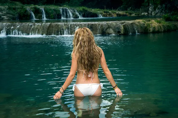
The limestone rock that makes up much of Guatemala creates some unique geographical wonders, like Semuc Champey. Nestled in the jungle, this site features multiple turquoise pools that spill into each other. The humid atmosphere and the inviting waters make this not only a photo-worthy spot but also a popular place to take a dip. Naturally formed waterslides let you swoop from one pool to the next. There’s nothing quite as incredible as swimming in these pristine waters.

add-on
The Belize Cayes: Ambergris Caye & Caye Caulker
Belize has a lot to offer and since it’s so close to Guatemala, you can take a short trip to visit the Cayes. These small islands are fun to explore and have a rich history full of Mayans, pirates, and even British loggers. We’ll check out the two largest options, Ambergris Caye and Caye Caulker, but you’ll also have time to snorkel over the second-largest coral reef system in the world, the Belize Barrier Reef. Have a blast snorkeling, swimming, and generally exploring the area.

add-on
Monterrico: Volcanic Sand & Sea Turtle Reserves
Have you ever seen a black sand beach? Monterrico is a stunning miles-long beach on the Pacific coast of Guatemala, made up of volcanic sand. The surf here is rough and strong, but these beaches are the nesting area for sea turtles. If you visit between July and January, you can help release baby sea turtles into the sea. Mangroves are another important part of Monterrico, full of birds and marine life. You can take a boat trip through the mangroves to catch a glimpse of some of the wildlife here.


