
8 Days in Guatemala: Tikal to El Paredon
Taking a one-hour domestic flight north to the Petén skips a long highway drive, giving you more time to explore the Mayan architecture of Tikal. From Guatemala City, our drivers connect you to the indigenous traditions of Lake Atitlán, the black volcanic sand of El Paredón, and the historic courtyards of Antigua.
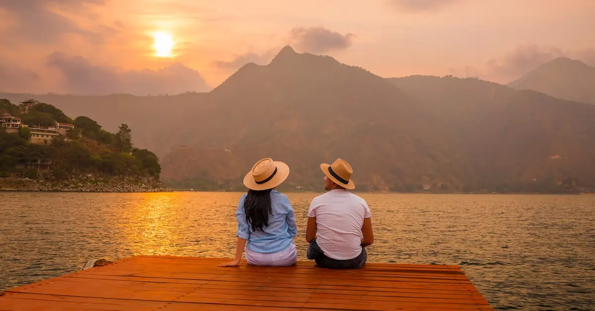
Your journey begins in the northern jungles of Guatemala, moving south into the volcanic highlands. The Petén region spans a third of the country, forming a biological corridor within the Maya Biosphere Reserve. Leaving the canopy, you travel into the Sierra Madre mountains. This range borders Lake Atitlán, a 340-meter-deep crater lake. Here, you walk alongside Maya farmers growing corn and beans in the volcanic soil along the shoreline.
Heading south from the mountains, the rivers guide you down to the warm Pacific coast. At El Paredón, ocean waves crash against a long stretch of dark volcanic sand, creating a relaxed beach town atmosphere next to a quiet network of mangrove canals. The route reaches the Panchoy Valley at Antigua Guatemala. Framed by three volcanoes, the city is a UNESCO World Heritage site celebrated for its restored colonial courtyards, cobblestone streets, and baroque church facades.
Flores Island
A colorful island oasis
Tikal
A Mayan metropolis lost in time
Monterrico
Guatemala’s volcanic beach escape
Antigua Guatemala
Iconic, historic walkways
Guatemala Trip: Highlights
The Petén region serves as your base for exploring the northern biosphere. You walk the limestone paths of Tikal National Park and visit the Tayazal peninsula, the specific site where the last independent Maya city fell to the Spanish in 1697.
In the western highlands, three volcanoes frame the deep basin of Lake Atitlán. Local boats cross the water between Tz’utujil Maya towns. In Santa Catarina Palopó, families paint their houses with traditional patterns, while residents in San Juan preserve a mix of textile arts, medicinal plant knowledge, and artisanal chocolate production.
The southern route leads to the dark volcanic beaches of El Paredón and the quiet canals of the Sipacate-Naranjo National Park. You spend your final days walking the historical avenues of Antigua Guatemala, where ruined monasteries sit beside restored colonial courtyards.
Your 8-day Guatemala Itinerary
Day 1: Arrival and Flores Island
Landing at La Aurora International Airport in Guatemala City, you board a one hour flight covering the 260-kilometer distance north. This short air bridge skips the highway drive and brings you into the Petén region.
Your driver meets you at the Mundo Maya International Airport for the 10-minute transfer to Flores Island. Red-roofed houses cover this island, linked to the mainland town of Santa Elena by a single road built across the lake surface.
- Two nights in Flores Island.
Day 2: Tikal National Park and Lake Peten Itza
The 65-kilometer drive from Flores Island takes about an hour and a half, bringing you to the park entrance. Exploring the Tikal ruins requires a moderate four to five-hour walk covering about 8 kilometers of jungle trails. The path starts at Complex Q, where twin pyramids mark the end of a 20-year Maya calendar cycle. Walking the limestone Tozzer Causeway leads into the Great Plaza. Temple I stands on the eastern side, built with nine stepped levels to protect the tomb of ruler Jasaw Chan K’awiil I. Standing in the center of the plaza and clapping your hands creates an echo that mimics the exact chirp of a quetzal bird. On the western side, builders carved the portrait of the ruler’s wife into the wooden lintels above the door of Temple II.
South of the plaza, you walk through the Central Acropolis. This maze of 40 courtyards served as the royal palace, and inside Maler’s Palace, you can still see original Maya graffiti scratched into the interior walls. The dirt path continues south to Temple V. Unlike the other pyramids, this 57-meter shrine has rounded corners and a single room at the top. Our morning route enters the Mundo Perdido complex. As the oldest section of Tikal, the Maya used this open plaza to track the sun and the stars. The buildings here look completely different from the rest of the park, showing design ideas brought over from central Mexico. The Plaza of the Seven Temples sits adjacent, containing a triple ballcourt.
Arriving back at Flores in the late afternoon, you board a wooden boat at the dock. A 15-minute ride covers the 2 kilometers across Lake Petén Itzá to the San Miguel peninsula. At the ARCAS wildlife rescue center, you walk the forest trails to observe macaws and spider monkeys recovering from the illegal pet trade. The boat crosses to the Tayazal peninsula, where you walk past the Caballo de Piedra (Horse of Thunder) monument and hike the dirt trail to the Rey Kanek viewpoint, looking down at Flores Island. The boat pulls up to Chechenal beach, where you can swim in the lake or jump from the wooden pier while listening to howler monkeys in the trees
Day 3: Lake Atitlan
Catching a morning flight back to Guatemala City, your driver heads up the Inter-American Highway into the Western Highlands. Covering the 115 kilometers takes about three and a half hours due to the winding mountain roads. The air cools as Lake Atitlán comes into view during the descent from Sololá.
A 30-minute drive covers the 15 kilometers along the shoreline to the lakeside town of San Antonio Palopó, where terraced onion fields cut into the hillsides. The 16th-century whitewashed church stands near the water, offering a quiet look at daily community life. Local artisans shape river clay by hand. They finish the pieces using lead-free ceramic paint and specialized ovens, a technique designer Ken Edwards brought to the community in the 1990s.
In Santa Catarina Palopó, families paint their adobe houses with geometric patterns. Through a community project, they use stencils of the two-headed eagle and the local pepesca fish to create murals that match the women’s hand-woven tunics. Residents harvest the shoreline reed beds to weave mats. Just down the rocks, natural hot springs bubble up directly into the lake.
- Two nights in Lake Atitlan.
Day 4: Mayan Villages, Coffee Cooperatives, Lake Trails
Boarding a boat with your guide, a 30-minute ride covers the 15 kilometers to San Juan La Laguna. Walking up from the dock, an installation of suspended umbrellas shades the main street. Tz’utujil painters cover the walls along this avenue with murals documenting the history of the town. You walk past local art galleries to reach the Casa Flor Ixcaco cooperative, where weavers anchor cotton threads on backstrap looms. The morning walk concludes at a community workshop to see residents roast raw cacao for chocolate production.
The afternoon offers a choice between two hikes. The Rostro Maya trail starts near Santa Clara la Laguna at 2,800 meters. This two-hour hike covers a 2.5-kilometer round trip. You walk past working corn fields and climb a rock formation shaped like a sleeping face to reach a ridge looking out over the lake. Alternatively, the hike to the Mirador de Cerro Kaqasiiwaan takes 45 minutes to cover 1.5 kilometers. You walk up 95 concrete stairs painted with corn and birds to reach a wooden viewing deck built over San Juan.
A 10-minute boat ride covers the 2 kilometers along the shoreline to San Pedro La Laguna. At the La Voz cooperative, you walk through shaded fields where farmers grow Arabica beans in the volcanic soil. You sit down at the cafe to taste the freshly roasted cup. Walking through the town’s alleys, you enter the municipal market, where farmers trade fresh produce, dried chilies, and lake fish in a bustling daily exchange.
A 15-minute boat ride covers the 3 kilometers to San Marcos La Laguna. The dirt footpaths here wind through avocado orchards and pass local yoga centers. Designed without paved roads, the town offers a quiet environment. These trails lead into the Cerro Tzankujil nature reserve, where you walk the shaded 2-kilometer paths along the limestone cliffs for clear views of the water.
Day 5: Sugar Cane Fields, El Paredón, Sea Turtle Release
Your driver takes the RN-14 highway away from the volcanic highlands into the coastal plains of Escuintla. The 150-kilometer drive takes about three and a half hours, with the temperature rising as the mountain pine forests transition into flat sugar cane fields. You arrive at the dark, iron-rich sand of El Paredón. This coastal town attracts a surfing crowd with its consistent waves, rustic sand-floor cafes, and boutique eco-lodges.
A local conservation hatchery organizes an afternoon sea turtle release. Workers rescue Olive Ridley eggs from poachers and bury them in safe sand pens for 45 days. The nesting season peaks from September to December. You watch the newly hatched turtles crawl toward the surf at sunset. Biologists choose this specific time because the midday sand would burn the turtles, and the evening light hides them from hunting seabirds.
- Two nights in El Paredón.
Day 6: Mangrove Canals and Pacific Waves
The morning in El Paredón brings strong Pacific surf. Stepping away from the ocean, you join a local guide for a two-hour, 8-kilometer boat tour through Sipacate-Naranjo National Park. The boat passes the roots of red mangroves to reach Poza del Nance, a calm stretch of water where Pacific green turtles feed on seagrass. You stop at a salt farm to watch workers boil saltwater in clay ovens to harvest black salt, using a pre-Columbian technique. Returning to town, you spend the afternoon resting by the ocean.
Day 7: The Courtyards of Antigua Guatemala
Heading inland from the coast, a two-and-a-half-hour drive (100 kilometers) brings you to Antigua Guatemala. To understand the city’s layout, your guide takes you on a three-hour, 3-kilometer walking tour through the historical streets. The route begins at the Cerro de la Cruz viewpoint, looking down at the colonial streets shadowed by the Volcán de Agua. In the city center, you visit the yellow church of La Merced. The builders used thick, low columns to earthquake-proof the building, and sculpted vines and grapes into the facade to represent the rich harvests of the Panchoy Valley.
You walk beneath the Santa Catalina Arch, built in 1694 so cloistered nuns could cross the avenue unseen. Walking south over river stones, you stop at the Tanque La Unión. At this colonial public laundry, running water flows through open basins where locals still hand-wash textiles today. Continuing down the block, you step into the Plaza Mayor, bordered by the 1738 Sirens Fountain and the arches of the Palacio de los Capitanes Generales.
Stepping away from the plaza, you walk through the San Jose Cathedral ruins to see the brick arches that collapsed during the 1773 earthquake. Conquistador Bernal Díaz del Castillo is buried beneath the main altar. Walking a few blocks east, you enter the San Francisco Sanctuary, framed by its 16th-century walls. Inside, visiting pilgrims tap the stone tomb of Hermano Pedro and leave small offerings. The afternoon finishes in the courtyards of Casa Santo Domingo, a 17th-century convent where ongoing archaeological digs uncover historical crypts.
For dinner, you travel up the hill to El Tenedor del Cerro. This restaurant sits surrounded by pine trees, offering sweeping views of the Agua, Fuego, and Acatenango volcanoes. The menu blends Guatemalan ingredients with international techniques, serving specialties like wood-grilled steaks and artisan pizzas. You dine in a refined yet relaxed atmosphere, surrounded by outdoor art installations created by renowned local sculptor Efraín Recinos. The property also includes walking trails and small museums, allowing you to take in the culture and the views as the city lights turn on in the valley below.
- One night in Antigua Guatemala.
Day 8: Departure from Guatemala
Enjoy a cup of locally roasted Guatemalan coffee in the courtyard of your hotel. The beans grown around Antigua are known as “Strictly Hard Bean,” grown in the mineral-rich volcanic soil that creates their famous flavor.
Based on your flight schedule, your driver collects your bags for the 40-kilometer drive back to La Aurora International Airport, which takes about an hour. You leave carrying the physical memories of the Petén jungles, the western volcanoes, and the Pacific coast.
map, expenses & price
Expenses included:
-Private transportation.
-Domestic flights.
-Seven nights of hotel accommodations.
-Local professional on-site guides.
-All park entrance fees.
-Tours and excursions as listed.
-Daily breakfast.


