The 11-Day Guatemala & El Salvador Journey
A stone path across the Great Plaza at Tikal leads directly to the base of the Temple of the Great Jaguar. High in Cerro Verde National Park, shaded cloud forest trails open up to clear views of the active Izalco Volcano. Down on the coast at El Tunco, newly hatched sea turtles cross the flat black sand to reach the Pacific surf.

This 11-day route starts in the Guatemalan highlands, moving from the cobblestone grid of Antigua to the steep volcanic shores of Lake Atitlán. A short domestic flight then shifts the itinerary north into the Petén basin. Here, the island town of Flores acts as the launching point for trekking through the dense jungle to reach the towering limestone pyramids of Tikal.
From the northern ruins, the route crosses south into El Salvador. The colonial streets of Suchitoto and the waters of Lake Suchitlán anchor the second half of the trip. The final days push up into the Cerro Verde cloud forests and the active high-altitude coffee estates of the Ruta de las Flores before ending the journey down on the Pacific coast.
Antigua Guatemala
Historical charm
San Salvador
Historic streets. Safe, modern energy
Santa Ana Volcano
El Salvador’s powerful geology
Ruta de Las Flores
Art, culture & gastronomy
Guatemala & El Salvador: Trip Highlights
Small private boats cross the deep waters of Lake Atitlán, connecting directly to the Tz’utujil community of San Juan La Laguna. Inside the village, local weavers demonstrate traditional backstrap loom techniques alongside open-air medicinal herb gardens.Back in the valley, the cobblestone streets of Antigua Guatemala preserve centuries of Spanish colonial history. Ruined brick convents, yellow plaster church facades, and massive stone laundry plazas still stand exactly where they were built along the city’s original 1543 grid.
Up in the northern Petén department, small local motorboats—known as lanchas—navigate Lake Petén Itzá to access the archaeological artifacts on Santa Bárbara Island and the white shores of Chechenal Beach. Deeper into the Maya Biosphere Reserve, the limestone pathways of Tikal cut straight through the dense jungle. At the base of Temple V, the 57-meter-high stone pyramid rises directly out of the excavated plaza and breaks right through the forest canopy.

Across the border, daily life in the colonial town of Suchitoto centers around the white facade of Iglesia Santa Lucía and the surrounding cobblestone plaza. Further south, thick layers of volcanic ash preserve the ancient Maya farming village of Joya de Cerén. West of the archaeological site, dense cloud forest trails cut through the Apaneca-Ilamatepec mountain range inside Cerro Verde National Park, bordering the active coffee estates of the Ruta de las Flores. Down on the Pacific coast, local conservation crews track humpback whales along the offshore reef of Playa Los Cóbanos.
Day 1: Guatemala City & Santa Catarina Palopó
When you land at La Aurora International Airport in Guatemala City, your guide will meet you in the arrivals hall to start the drive out to the Western Highlands. The trip takes about three and a half hours along the Inter-American Highway to reach the Sololá region.
On the way up the mountains, you pull over at the Mario Méndez Montenegro lookout. The air gets crisp at this altitude, and you get your first view of Lake Atitlán stretching out 600 meters below. From there, you drive down into Panajachel to drop off your bags at the hotel. After checking in, it’s a quick fifteen-minute drive east along the shore to your first stop. Your total time exploring Santa Catarina Palopó this afternoon will depend entirely on what time your flight lands at the airport.
Santa Catarina Palopó
When you drive into the village, you’ll see hundreds of houses painted in bright blue and turquoise patterns against the green hills. Your walk starts at the main plaza, which is part of the Pintando Santa Catarina Palopó project. Since 2017, families and local artists have painted over 800 homes using stencils that match the traditional weaving patterns of the local clothing.
Just across the square, you step inside the Pintando El Cambio Museum, which is a small cultural center in a traditional home. The people there explain how families chose their own colors to represent water, farming, and the nearby volcanoes. From there, you walk down the cobblestone street to the Santa Catarina Palopó Church. It’s a simple white colonial building with a classic bell tower that serves as the main church for the Kaqchikel Maya community.
A block past the church, the street opens up into local artisan stalls and weaving workshops. You can watch Kaqchikel women using traditional backstrap looms tied around their waists and anchored to a post. They use their weight to keep the threads tight, weaving the deep blue and turquoise textiles that inspired the painted houses.
From the workshops, you walk down to the lakefront boardwalk. The path leads right to the main public pier where fishermen tie up their wooden boats. If you walk a short distance east along the shore from the pier, you’ll find the Las Aguas Termales of Santa Catarina. Since the lake sits in a volcanic basin, warm groundwater seeps through the rocks, heating up shallow pools where locals come to relax.
Before the sun goes down, you drive over to the Palopó lookout. From this wooden deck, you get a clear view across the water to the Tolimán Volcano and San Pedro Volcano. It’s a great spot to watch the sunset over the lake before a ten-minute drive back to Panajachel. For dinner, you can go to Restaurante Hana inside the Casa Doña Rosa courtyard to get a bowl of hot udon noodles under the patio lights.
Day 2: Boat Tour on Lake Atitlán
In the morning, a private boat takes you from the Panajachel docks across the lake to San Antonio Palopó. Terraced onion fields cut straight into the steep hillsides right above the water’s edge.
San Antonio Palopó
The street from the pier leads straight to the main square. The white San Antonio de Padua Church stands right on the plaza, directly across from a local market filled with fresh produce from the surrounding hills.
Two blocks away, you visit a women’s weaving cooperative where Kaqchikel artisans use traditional backstrap looms to make red and blue textiles. Further up the street, the artists at the Ken Edwards Pottery Workshop and nearby family studios hand-paint ceramic stoneware in open-air workspaces. Before heading back to the boat, a short walk up the hill to a traditional chocolate workshop offers a taste of freshly roasted cacao.
San Juan La Laguna
From there, you boat across the lake to San Juan La Laguna. Stepping off the pier, you walk down streets shaded by hanging hats and umbrellas, where bright murals of Tz’utujil Maya legends cover the building walls.
Walking up the main avenue, you stop at the Casa del Tejido cooperative to see weavers boiling local leaves to make natural blue dyes for cotton threads. Right next door, sample artisanal chocolate or browse oil paintings at the Arte Maya Xocomeel gallery. You pick up fresh bread from the Alma de Colores bakery before heading up to the main plaza and the historic church.
Just off the plaza, local midwives grow traditional remedies inside the Q’omaneel medicinal herb garden. A short path nearby leads straight to a stingless Mayan bee sanctuary. You finish the town walk in the quiet gardens of Eco-Hotel Mayachik´ before grabbing a cup of organic coffee at Café La Voz.
Rostro Maya or Mirador Kaqasiiwaan
For the afternoon, choose between two different trails:
- Option A: Hike to Rostro Maya: This steep trail goes straight up through a pine and oak forest. About halfway up, a massive wooden hand platform offers a clear view over the valley. The path passes sacred rock altars still used for fire ceremonies before reaching the summit, which looks straight down the center of the lake at the San Pedro, Tolimán, and Atitlán volcanoes.
- Option B: Walk to Mirador Kaqasiiwaan: This shorter walk follows a paved trail up 300 stairs through local coffee fields. After passing small vendor stalls and a trailside cafe, you reach a circular wooden deck covered in Tz’utujil murals looking directly over the town’s rooftops.
Finally, a short boat ride takes you to San Marcos La Laguna. Paths lined with avocado orchards lead into the Cerro Tzankujil Nature Reserve. Spend the rest of the afternoon on the limestone cliff platforms by the water, watching the sunset over the lake before heading to a nearby cafe for dinner.
Day 3: Discover Antigua Guatemala
Antigua Guatemala City Tour: Cerro de La Curz to Tanque La Unión
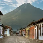
Your walking tour starts at the northern hilltop Cerro de La Cruz Lookout (Hill of the Cross). The open stone plaza offers a clear view straight down at the historic colonial streets stretching out to the base of the massive Agua Volcano. Strolling down from the hill brings you straight to La Merced Church to see the brilliant yellow plaster baroque facade and the 27-meter-wide Fuente de Pescados (water lily fountain) hidden inside the courtyard.
The cobblestones of 5a Avenida Norte lead straight beneath the yellow Santa Catalina Arch. Passing the ruined brick market facade at El Carmen, a short walk down the block reveals the restored stone front of La Compañía de Jesús. The path opens directly into the Plaza Mayor (Central Park), where massive, double-tiered stone arcades frame the Palacio del Ayuntamiento and the Palacio de los Capitanes Generales.
On the eastern side of the square, the white facade of the San José Cathedral leads into the roofless 1541 cathedral ruins, where old stone stairs descend into the underground crypts beneath the altar. Moving onward to the Convento de Las Capuchinas, you can explore the Tower of Retreat to see the 18 circular, private nuns’ cells built around a central pillar before visiting the underground choir rooms. Elegant, double-tiered stone arches await inside the Ruinas de Santa Clara, just steps away from the quiet San Francisco Sanctuary where the physical tomb of Hermano Pedro sits.
Over on the western edge of town, the grounds of La Recolección feature dirt paths winding directly through massive piles of fallen masonry and broken brick vaults left exactly where they collapsed in 1773. A short trip up the nearby hillside to Santo Domingo del Cerro reveals modern, open-air art galleries packed with original pieces by Efraín Recinos. Walking back toward the center brings you to Tanque La Unión, a wide public square built around 22 historic stone laundry cisterns bordered by palm trees. Right around the corner, Dulcería Doña María Gordillo sells authentic canillitas de leche (soft milk candies).
To finish the afternoon, a sunset drink on an open rooftop terrace offers a direct view of the three giant peaks circling the Valle de Panchoy (Panchoy Valley): Volcán de Agua (Agua Volcano), Volcán de Acatenango (Acatenango Volcano), and the active Volcán de Fuego (Fuego Volcano). Three distinct spots right in town work perfectly to wrap up the historic city walk:
- Aqua Antigua: An upscale terrace space designed with a central courtyard pool, outdoor fire tables, and a dedicated wine lounge.
- The SNUG Antigua: A rooftop Irish pub with an elevated 360-degree deck built for casual drinks and clear sightlines across the city tile roofs.
- Café Sky: A multi-level rooftop deck positioned for a direct view of the sun dropping behind the smoking peak of Volcán de Fuego.
Day 4: Lake Petén Itzá & Biotopo Cerro Cahui
Leaving your hotel in Antigua Guatemala, a one-hour drive to Aeropuerto Internacional La Aurora (La Aurora International Airport) connects to a one hour domestic flight into the northern lowlands. Landing at Aeropuerto Internacional Mundo Maya (Mundo Maya International Airport) places you right in the heart of the Petén department, where a short 10-minute ride takes you across the man-made causeway straight onto Isla de Flores. Stepping out of the vehicle, the air feels noticeably warmer and heavier as you look at the red-roofed houses packed tightly onto the small island, completely surrounded by Lago Petén Itzá (Lake Petén Itzá).
Lake Peten Itzá
Down at the island waterfront, you board a private lancha (a small wooden motorboat) to begin exploring the lake. A quick 500-meter cruise across the water brings the boat directly to Islote Santa Bárbara. Stepping onto this tiny islet, you can walk straight into a small museum housing pre-Columbian Maya ceramics and historical radio equipment collected by local historian Julio Tres.
Leaving the museum, you take a short boat crossing through a narrow channel straight to the Península de San Miguel (San Miguel Peninsula). Stepping off the boat, a 400-meter hike up a dirt trail takes you through tree-covered archaeological mounds to reach the Mirador del Rey Canek (Rey Canek Lookout). From this wooden structure, you can see a clear view looking straight back over the water at Isla de Flores. A short boat ride along the northern shoreline brings you to Playa Chechenal (Chechenal Beach), a stretch of pale sand backed by thick jungle. Here, wooden piers extend directly into the turquoise lake water. Heading west for another kilometer in the boat, you stop at Jorge’s Rope Swing, a local wooden platform built over the water on the western edge of the peninsula.
Leaving Jorge’s Rope Swing, you cruise three kilometers east across the lake to reach the ARCAS Wildlife Rehabilitation Center. Hidden in the dense forest, workers at this site rehabilitate confiscated wildlife like scarlet macaws and spider monkeys to release them back into the wild. Just 500 meters south of the facility, the lancha pulls up to the docks of Islote Petencito (Petencito Island), a forested islet where you can follow shaded pathways past native deer and jaguars in large enclosures.
Biotopo Cerro Cahuí Rainforest
Leaving the islands behind, you travel 15 kilometers northeast across the open lake to the lakeside village of El Remate. Stepping off the boat onto the wooden pier, you walk 100 meters inland to reach the ranger station at the main entrance of Biotopo Cerro Cahuí (Cerro Cahuí Biotope). This protected tropical forest covers a massive limestone ridge rising right out of the water.
The hike begins on Sendero Las Monas (The Monkey Trail), a steep dirt path running under tall cedar and mahogany trees. Hiking one kilometer up the limestone incline brings you to the Mirador Las Monas (Las Monas Lookout), a wooden structure where you can get a wide look over the eastern expanse of the lake. Continuing 500 meters further brings you onto Sendero El Chiclero (El Chiclero Trail), a loop named after the workers who historically extracted natural gum from the trees. You can follow this loop straight to Mirador El Pucté (El Pucté Lookout), the highest vantage point in the reserve.
Heading two kilometers down the opposite side of the ridge, the dirt paths finish right at Playa de Cahuí (Cahuí Lakeside Beach). Sitting in the sand under the forest canopy gives you a chance to rest near the shallow water before the walk back to the boat.
As the late afternoon approaches, walking 200 meters back to the El Remate waterfront brings you right back to the waiting lancha. The return journey serves as a quiet sunset cruise covering the 20 kilometers back to Isla de Flores. Stepping onto the docks just as the sky turns dark allows for a short one-block walk along the Malecón (waterfront promenade) to eat dinner at Raíces Bar and Grill. Sitting on their wooden deck over the water, you can order a plate of fresh blanco (a local whitefish caught directly in the lake) to close out the day in Petén.
Day 5: Tikal Tour, Expedition Built on Lived Experience
We can complete the 65-kilometer journey from Isla de Flores to the main entry gates of Parque Nacional Tikal (Tikal National Park) in about an hour and a half by car.
Mendez Causeway and the Maya Calendar
You step onto the initial 1.5-kilometer broadleaf forest trail to walk beneath a thick jungle canopy filled with native ceiba, cedar, and mahogany trees. Leaving the main path, you follow the Méndez Causeway southeast to reach Temple VI, also known as the Temple of the Inscriptions. On this structure, you can see rows of carved hieroglyphs covering the 12-meter-high stone roof comb to document the dynastic history of the ancient city. Walking north, you arrive at Complejo Q and Complejo R (Twin Pyramid Complexes Q & R), where you walk past nine plain stone pillars erected in a row to commemorate the completion of a 20-year K’atun cycle in the Maya calendar.
Temple IV (Temple of the Two Headed Serpent)
We’ll follow the raised limestone surface of Maler Causeway to find stone altars and a replica of Stela 16 at Complejo P and Complejo M (Complex P and Complex M) that record ancient political alliances and honor past rulers. Turning west onto Maudslay Causeway, you pass Complejo O and Complejo N (Complex O and Complex N) situated on the edges of the ancient highway. At the far western edge of the path stands the 65-meter Temple IV (Temple of the Two-Headed Serpent), built as a massive funerary monument for the ruler Yik’in Chan K’awiil. You can walk up the wooden steps attached to the back of the structure to reach the summit, looking out at the stone roof combs of Temples I, II, and III breaking through the top of the jungle canopy.
Moving onto Tozzer Causeway, you can step inside the multi-chambered rooms of Palacio de Las Ventanas (Bat Palace / Palace of the Windows), which functioned as an elite administrative palace. Nearby, Temple III (Temple of the Jaguar Priest) remains intact as the last major funerary pyramid constructed in the city, recognizable by its thick roof comb and unexcavated, grass-covered mounds.
Plaza of the Seven Temples, Mundo Perdido & Temple V
You head south to reach the grassy lawns of the Plaza of the Seven Temples, where a row of seven identical small shrines sits opposite a triple ballcourt layout built for ceremonial Mesoamerican sporting events. Passing the 24-meter-high stone platform of the South Acropolis, you enter Mundo Perdido (The Lost World) to stand before the Great Pyramid to see its talud-tablero (alternating sloped walls and flat panels) stone design alongside the surrounding E-Group astronomical structures designed to align with the solstices.
Walking further east, you find Temple V, a mortuary shrine standing 57 meters high with distinctive rounded corners and a single, unbroken vertical stone stairway. Next, you enter the courtyards of the Central Acropolis, an administrative and residential palace for Maya nobility, to observe the original wooden lintels still supporting the ancient stone doorways.
The Great Plaza: Temple I, Temple II and North Acropolis
Walking directly into the ceremonial heart of the city, you enter the wide expanse of the Gran Plaza (Great Plaza), bordered on opposite sides by Temple I (Temple of the Great Jaguar, containing the tomb of Jasaw Chan K’awiil I) and Temple II (Temple of the Masks). On the northern edge of the square, you can explore the North Acropolis, a layered royal necropolis where you can find large plaster masks representing rain and sun deities inside protected archaeological trenches.
To finish the tour, you follow the main trail back to the visitor center. Before leaving, you can stand around the topographical scale 3D model to trace the exact dirt paths, reviewing the specific temples, plazas, and causeways explored throughout the day. Afterward, you return to your hotel on Flores Island, where you can unwind by swimming or sitting right next to the calm water of Lake Petén Itzá.
Day 6: Suchitoto, El Salvador
Travel to El Salvador
A brief ten-minute drive to Mundo Maya Airport connects with the return flight back to Guatemala City. Leaving the capital, the route heads southeast down the Inter-American Highway toward the border post at Valle Nuevo. Plan for about five hours on this 220-kilometer stretch, which allows enough time to clear international customs and drop from the cool Guatemalan highlands into the warmer, lower altitudes of El Salvador.
Colonial Suchitoto
By late afternoon, the drive brings you right onto the historic cobblestone streets of Suchitoto. Looking down from the high volcanic ridge reveals sweeping views of Lake Suchitlán, where old Spanish colonial homes feature thick timber doors and weathered red clay roofs. Right outside the central church, local families heat up open-air griddles to shape, pat, and roast traditional Salvadoran pupusas (thick corn tortillas stuffed with cheese, beans, or pork).
If you want a sit-down meal, you can order these handmade specialties straight from the kitchens at Portal el Buen Sabor or La Lupita del Portal. To explore a broader selection of regional recipes, step inside the open-air courtyard at Casa Flamenco Suchitoto, or grab a seat on the outdoor terrace at La Posada de Suchitlán to dine directly above the waterfront.
Day 7: Suchitoto, Los Tercios Waterfall & Lake Suchitlán
Cultural Landmarks of Suchitoto
The old cobblestones of the Plaza Mayor (Main Square) place you right beneath the towering baroque columns and whitewashed stucco facade of Santa Lucía Church. Arriving early in the morning allows you to watch the shadows of the twin bell towers stretch across the central fountain before the daily heat settles over the stone square. Inside the main sanctuary, the cool air reveals six massive interior columns hand-carved from solid mahogany trunks that support the long, narrow nave. This raw woodwork contrasts sharply with the structural white metal plates imported piece by piece from Belgium in the late 1800s.
To continue the exploration, a short walk down the side lanes leads straight to the private iron gates of the Casa Museo de Alejandro Cotto. Here, you move through interior corridors filled with old azulejo tiles, classical stone basins, and collections of antique libraries. Across the next block, the grand entryway of the Centro de Arte para la Paz opens into a restored 1840 convent. Thick-walled stone cells inside now display regional historical testimonies and rotating collections of contemporary local sculptures.
The neighborhood loop concludes inside the sun-lit patios of the Arte Añil workshop. The rich, sharp scent of fermenting vegetation fills the air as local craftsmen submerge green jiquilite leaves (the local wild indigo plant) into stone vats to extract the rich organic sediment of blue añil (indigo) dye used for hand-woven textiles.
Los Tercios Waterfall and Ciudad Vieja
Behind the crumbling brick facade of the Teatro de las Ruinas at the edge of the town center, the town streets transition into a dirt track. You follow this path for 1.5 kilometers as it moves down through the local forest canopy.
The track drops down toward the Las Ánimas stream. A short scramble down the bank ends directly at the base of Los Tercios Waterfall. Here, a nine-meter vertical cliff face resembles a massive geometric wall built entirely from dark hexagonal basalt stone blocks stacked tightly together.
A brief drive past the outer municipal limits takes the route into the hot, open fields of Ciudad Vieja. Pacing across the archaeological grounds provides a clear view of the exposed stone foundations and original 1528 street grid layout of the first permanent Spanish town in the region.
Lake Suchitlán
The route continues down the steep ridge directly to the Puerto San Juan docks. Warm, humid air blows off the water as you walk down the loading ramps to meet the local boatmen waiting by the shoreline.
Boarding a flat-bottomed wooden boat allows you to look out over the wide, reflective surface of Lake Suchitlán, a massive artificial reservoir created by blocking the river with the Cerrón Grande dam. The captain navigates through floating green mats of broad-leaf water lilies, moving carefully around shallow mudflats and looping closely past the rocky shorelines of isolated volcanic islets.
As the evening sky turns a deep orange over the water, the quiet roar of the outboard motor stops near the protected sanctuaries of Isla de los Pájaros and Hermit Island. The launch drifts in total suspension, letting you hear the nesting calls of snowy white egrets and heavy pelicans as they settle into the low branches of the flooded trees to roost.
Day 8: Joya de Cerén & Cerro Verde
Joya de Cerén Archeological Site
A westbound drive into the Zapotitán Valley passes rows of sugarcane and broad-leaf banana fields. Arriving at the wooden park sign at the entrance, the dry heat of the open valley air hits immediately. This is Joya de Cerén, a 1,400-year-old Maya farming village famously buried and preserved by volcanic ash. Unlike the towering stone pyramids built by elite royalty found elsewhere, this site froze an ordinary farming community in time, showing exactly how everyday people lived. Before heading out to the ruins, a stop inside the Museo de Sitio Joya de Cerén (the site museum) showcases the clay bowls, charred agricultural tools, and bean storage jars that survived the 600 AD volcanic eruption of Loma Caldera.
Past the museum, a 50-meter walk north under a large protective roof canopy reveals the excavated domestic center of the village. Looking down into the soil-packed pits, the remains of a family home built with a front porch sit clearly visible. Right beside this house are the short walls of a private storage room built from mud bricks, along with the curved outline of a circular kitchen. Just a few steps from these structures lie the kitchen garden plots. Here, the thick volcanic ash from the 600 AD Loma Caldera eruption perfectly cast the shapes of the maize stalks and agave plants exactly as they stood on that specific day.
Heading 40 meters east across the dirt path opens up the main public square that served as the village center. Here, the mud walls of a large residence border the community storehouse. Just behind these buildings sits a completely intact temazcal (an indigenous domed sweat bath used for physical cleaning), built with a low clay roof and a central steam hole. Another 20 meters further down the path sits the house of the local healer and a massive communal assembly hall where village elders held political meetings.
Finally, the southern edge of the excavation site overlooks a secondary residence facing the preserved rows of the outer farming fields. After exploring the perimeter ruins, a 100-meter walk back toward the entrance brings the tour to the local stalls, offering a look at artisan clay replicas of the historical pottery before continuing the drive.
Cerro Verde National Park
Leaving the valley heat behind, the road climbs higher into the Apaneca-Ilamatepec mountain range. At the Main Entrance Park Ranger Station of Cerro Verde National Park, sitting at 2,030 meters above sea level, the temperature drops noticeably under the thick cloud forest canopy. Following registration with the forest guards at the check-in point, a meeting with your mountain guide at the Casa 1800 Trailhead Junction kicks off the hike. From this central shaded hub, the itinerary continues with whichever of the two active volcano routes you selected during booking:
Route A: Santa Ana Volcano Crater
This route is classified as a moderate 4-kilometer hike that requires four hours of total walking time. The wide dirt trail climbs at a steady, gradual pace, making it a comfortable walk rather than a steep scramble.
The hike begins down through the forest shade, passing the official state forestry gate and the old trail split at San Marcelino. Beyond the dense tree canopy, the path transitions directly onto the exposed, zig-zagging stones of the main Santa Ana Volcano cone, where wild agave plants grow right out of the rock cracks. Past the stone observation tower, the trail ends right at the edge of the Santa Ana Volcano Crater rim overlook. Looking straight down into the massive volcanic bowl reveals hot, steam-emitting sulfur cracks and the bright turquoise acid lagoon resting at the very bottom. The descent follows the loose volcanic ash down the mountain face before returning to the shaded forest trail leading to the park entrance.
Route B: Izalco Volcano Lava Field
This route is classified as a strenuous 6-kilometer hike that demands six hours of intense physical output. The trek involves descending and climbing 3,000 total stone steps before a direct, straight-line push up a vertical cone of loose volcanic ash. For this harder mountain trek, the path starts straight at the secure checkpoint of the Izalco Trailhead Gate.
The hike begins with a steep descent down 1,500 stone steps through the trees. At the bottom, the forest ends abruptly, opening up to a wide field of black lava rock. A short walk across this hard, flat surface brings the trail directly to the base of the Izalco Volcano cone. The final push climbs straight up a forty-five-degree slope of loose ash, passing massive basalt blocks near the summit. Up on the active Izalco crater rim, hot gas vents push heat straight out of the ground, and the high vantage point offers a clear view of the Pacific coast far below.
Casa 1800: Cloud Forest Courtyard
The return hike heads back down the loose ash slope and tackles the 1,500 stone steps leading up to the ranger hub. Once back at the top, a wooden table in the nearby Casa 1800 restaurant courtyard offers a much-needed place to rest. Out in the cool mountain mist, a hot plate of fried yucca and a mug of thick local hot chocolate close out the afternoon.
Day 9: Ruta de Las Flores
This customizable itinerary follows the CA-12 highway through the Apaneca-Ilamatepec mountain range of western El Salvador. You will plan your schedule directly with your private guide to choose which specific towns, forest trails, and local markets you prefer to visit. Whether you want to focus on hiking, colonial architecture, volcanic hot springs, or traditional culinary markets, your guide will adapt the route on the ground to match your group’s personal pacing and interests.
Historic Towns
The highway corridor links several distinct cultural communities, each showcasing a different aspect of local indigenous heritage, colonial craftwork, or public art. Your schedule remains fully open to map out which settlements to explore with your guide, whether you want to focus on open-air artisan workshops or historic plazas.
- Ahuachapán: The northern gateway town features a historic central plaza and serves as the entry point to the mountain corridor.
- Concepción de Ataco: The central square of this colonial town showcases massive, colorful murals painted by local artists across traditional adobe shop walls.
- Apaneca: Sitting at the highest point along the route, this quiet settlement is characterized by its brisk alpine climate and dense stands of pine trees.
- Juayúa: The active central plaza of this mountain town transforms every weekend into a crowded market packed with open-air food stalls.
- Salcoatitán: This small residential stop offers quiet lanes and traditional food stalls specializing in local fried yucca.
- Nahuizalco: Local woodworkers at this southern market town carve traditional wicker furniture inside sidewalk workshops right along the road.
Waterfalls and Lagoons of the Apaneca Mountain Range
The cloud forests of the Apaneca-Ilamatepec mountain range hold multiple freshwater lagoons and waterfalls hidden inside the cloud forests. These destinations offer choices ranging from quiet crater lakes to freshwater swimming pools carved into sheer stone cliffs.
- Laguna Verde: The shaded shores of this green volcanic crater lake are lined by thick pine tree paths covered in pine needles.
- Laguna de las Ninfas: A secondary dirt track leads to the thick reeds and water plants around this quiet lagoon, where fields of wild water lilies blanket the shallow water.
- Los Chorros de la Calera: Cold spring water cascades down a sheer rock face into three stone swimming pools hidden in the forest outside Juayúa.
- Cascadas de Don Juan: Visit the private grounds of Finca San Rafael, a working estate where you can walk beneath a canopy of native shade trees to see a waterfall drop into a natural pool right beside rows of heirloom bourbon (Bourbon, a classic French-introduced heirloom variety known for a sweet, buttery flavor profile) and pacamara coffee trees (Pacamara, a prized Salvadoran hybrid variety known for producing exceptionally large beans).
Ahuachapán Hydrothermal Fields and Hot Springs
The subterranean volcanic activity of the Apaneca-Ilamatepec range surfaces at specific points along the valley floor. Depending on your preferences, you can visit areas displaying raw geothermal power or head to developed mineral pools designed for physical relaxation.
- Los Ausoles de Ahuachapán (hydrothermal vents): Massive columns of sulfurous steam rise directly from bubbling gray mud pots in this highly active geothermal field.
- Termales de Santa Teresa: These natural volcanic hot springs offer mineral pools, deep mud baths, and varying thermal temperatures to soothe muscles after a day of walking.
Adventure Parks and Lookouts
High ridgelines along the Ruta de Las Flores provide views of the coastal lowlands alongside structured outdoor recreation areas. These locations combine high-exposure mountain views with active paths designed for sports and valley observation.
- Café Albania: Located outside Apaneca, this outdoor adventure park features a massive labyrinth grown from manicured cypress bushes alongside a high-wire bicycle zip-line.
- Mirador El Divisadero (lookout): Stand on the wooden observation platform to look out over the lower valley towns that stretch toward the Pacific coast.
Juayuá Gastronomic Festival and Coffee Culture
The nutrient-rich soil of the Apaneca-Ilamatepec mountain range sustains both the local culinary markets and the historical farming trades. Coordinate with your guide to focus on traditional weekend street food festivals or explore the traditional sorting and milling techniques used to process coffee.
- Feria Gastronómica (Gastronomic Festival): Held every Saturday and Sunday on the main plaza of Juayúa, this food market features heavy plates of roasted rabbit, spiced sausages, and crispy fried pork cuts cooked over open charcoal grills. Traditional sweet pastries known as peluza (squash-seed sweet bread) pair naturally with a cold glass of chicha (fermented corn beverage) from the local bakers.
- El Carmen Estate: The historic brick buildings of this coffee plantation host a walking tour of the active beneficio (coffee processing mill), showcasing authentic 19th-century wooden machinery alongside freshly brewed cups of shade-grown bourbon coffee (Bourbon, a classic French-introduced heirloom variety known for a sweet, buttery flavor profile).
Day 10: Playa Los Cóbanos
Today is completely free for you to explore Playa Los Cóbanos, a protected marine sanctuary characterized by its golden sand formed from crushed coral. This underwater volcanic reef system shelters the largest community of hard corals along the Pacific coast of Central America. You can spend the morning walking the long beachfront, or we can arrange one of the optional coastal excursions below directly from the shoreline:
Boat Trip: Humpback Whale Watching
We board a local fiberglass boat at the Los Cóbanos shoreline to travel roughly 10 kilometers offshore into open water. Between December and March, your captain tracks the coastal currents to find active pods of humpback whales (a baleen whale species known for spectacular aerial breaches). Once we reach a sighting zone, the captain cuts the motor to maintain a quiet environment. You can stand at the edge of the boat to listen for the loud exhalations of water vapor and watch for the heavy tails breaking the ocean surface. On the return journey over the shallow reef, the crew serves fresh, sliced local pineapple to close out the trip.
Marine Excursion: Dolphins and Sea Turtles
A small motorboat takes us from the main docks to trace the inner edges of the volcanic reef. This route focuses on finding local bottlenose dolphins and native sea turtles. Cruising along the coastline, you can look out across the water to spot the dolphins swimming directly alongside the boat. Closer to the coral, your guide points out hawksbill turtles (an endangered sea turtle named for its pointed beak) and olive ridleys (a smaller, dark-green sea turtle) feeding below before they rise to the surface for air.
Reef Walk: Low Tide Pools
As the tide goes out and exposes the rock shelf, a local guide leads you directly onto the wet volcanic stones. A short walk across the flat reef brings us to isolated natural basins that trap the ocean water. Inside these clear pools, sea urchins, sea snails, and orange starfish sit perfectly visible against the coral. The exploration ends further down the shore at Playa El Faro and Playa El Amor, two deeper rock basins where you have time to swim in the calm water before the tide returns to cover the shelf.
Scuba Dive: SS Douglas Shipwreck
A short ride on a dive boat takes us out toward the deeper water of the outer reef. Down on the ocean floor, your divemaster guides you through the iron remains of the SS Douglas, an 1890 British steamship that sank with a cargo of local coffee. Today, the rusted hull frame and intact steam boiler serve as a natural reef, providing shelter for moray eels, triggerfish, and resting manta rays. Back on the deck after the dive, you can dry off your gear and drink a cold bottle of Pilsener (the local pale lager) during the cruise to shore.
Regardless of which excursion you choose, the late afternoon brings you back to the golden sand. As the sun sets over the Pacific, you can take a seat at one of the open-air wooden tables set up right on the beach. Here, you can eat a plate of fresh ceviche and listen to the waves break over the coral reef to finish your time on the coast.
Day 11: El Salvador Departure
A final two-hour drive covers the 100 kilometers between the Pacific coast and El Salvador International Airport (SAL). The morning pick-up time is scheduled directly around your specific flight, ensuring plenty of time for a stress-free check-in.
Your outbound flight lifts off from the coastal runway, passing over the Pacific Ocean and the green peaks of the Cordillera del Bálsamo (the Balsam Mountain Range). The trip ends with black volcanic ash still on your boots and a firsthand understanding of the indigenous history and daily local life that shape both nations—stretching from the deep limestone ruins of the Guatemalan Petén basin to the active lava fields of the Apaneca-Ilamatepec mountain range.
map, expenses & price
Expenses included:
-All private transportation.
-10 nights of hotel accommodations.
-Domestic flights
-Tours and excursions as listed.
-All park entrance fees.
-Professional local guides.
-Boat transfers
-Daily breakfast